Katahdin Shadows Campground
Summiting Mt. Katahdin in Maine was going to be the pinnacle of our hiking this year. It's a 11 mile hike (round trip) with a gain of about 3800 feet. We would take Chimney Pond Trail connecting to Saddle Trail to the summit.

Picture of Knife's Edge on Mt. Katahdin (pic from the web)
We drove into Baxter State Park to talk to the rangers about the latest weather and trail conditions. It sounded pretty good until he looked past us and asked if that was our truck (pointing to Curts's truck). We said yes. They said you can't take that up there. WHAT? WHY? Turns out there are many restrictions on the road that leads to the trailhead/campground that we would need to use. There are height, width and weight rules. And no duallys allowed. I don't know how I missed that! There are also no shuttles in. You have to get your own ride or hike to the trail head. That's 8 miles one way just to get TO the trailhead. WHAT?? Well... I guess we'll have to take a pass. The Appalachian Trail is 2190 miles long, starting in Georgia and ending here in Maine. We've hiked the very beginning of the AT and several short segments along the way. We were really looking forward to rubbing that very last marker at the summit. We were bummed. Well, I might have been the only one. I think the others were relieved. Guess that'll have to wait for another year. We chose a couple of other short hikes instead.

Camping with Curt & Glenda of Illinois Campers blog.
We camped at Mt. Katahdin Shadows Campground. Nice place, pretty grounds and very clean. FHU for $37.

A colorful painted boulder along the road to the park.
We will be back to Baxter State Park to hike the Cranberry Pond Trail tomorrow.

This time Glenda and I were out looking for a geocache.


The fire danger was low until Glenda stood next to Smokey! A heart carved into a Birch tree.

We had to trudge around a lot, but we found it!

The four of us headed out to Cranberry Pond and then connected with Rum Pond Trail. Another mile back up the road and we had a nice loop trail just under 5 miles. We knew this would be interesting as a family of 3 emerged from the trail just as we were entering. They all had mosquito nets on their heads and hats. They warned us it was pretty brutal out there. We were coated in DEET so we were ready to give it a go.
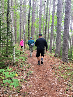


The mosquitoes weren't too bad at first then they started to swarm a bit. As long as we kept going it wasn't too bad.

Those were the only shots we could get of the lake. Most of the hike was in the woods.


A mushroom and some interesting fungus growing on a birch.

The trail was getting a bit narrow and hard to follow with all the downed trees.

Then it just ended. Hmmm. Checked out our map and figured we missed the turn.

Back on track connecting to Rum Pond Trail which turned out to be much prettier than the lake.


Little creeks would appear and disappear here and there.


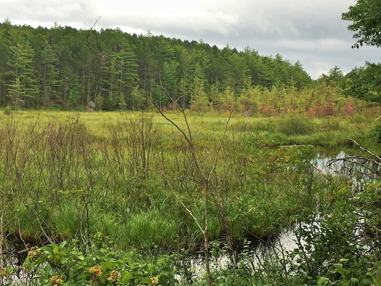
As we hiked back on the road back to the truck we just couldn't believe there weren't moose in these wet, boggy, grassy fields.

Pretty pond.

Still no moosies.


Uh-oh. The road (up to the trailhead) is rough. The folks we hiked past had a flat but had it all under control. Maybe it was a good thing we couldn't bring our dually up. The guys told us it is very narrow further up.

We took a drive out to find an earthcache and some that were hidden in an old abandoned town.

When you can't wait for cross-country ski season to start.

We've heard this is the smallest waterfall in New England. The falls are approximately 300 feet wide and have small protruding stones (grindstones) that rise only a foot or two above the level of the water. These stones make a path across the water and it's better to see in person than the pictures can capture.


We did find the cache. It's the first gaging station marker we've come across.

Next up was a couple of caches hidden in the old town of Davidson which was home to a log mill and clothes pin factory. The caches haven't been found for almost 4 years so we were determined to find them. It even had wooden sidewalks along main street. All that is left now are the foundations from the past. This town was busy until 1931 when for some reason the town stopped being a town and slowly returned to nature. We walked about 2 or 3 miles to find these caches. We asked permission from the farmer to park and then walk down the property. He was very excited to have us there and told us to watch for the hanging toilet seat. That's where the town began. We saw pictures of the town on the geocache page, but it sure is different now. You'd never know a town was ever there. Mature trees cover the area as well as bushes and weeds. Thick in some areas. The trail is barely visible and sometimes not there at all.


Apples and flowers planted by the old townsfolk?

There's the toilet seat!

See how thick it is?

If you look closely above, you can barely make out the foundations.

Steve got this picture of the old safe.

Across some railroad tracks and there was another cache. Glenda and I opted to wait at the tracks. Surprisingly, no ticks were found on anyone.

This is the old barn on the landowners property.


Done for the day. Now a special dinner for the Birthday Boy and pie.


Hurley enjoying his "indestructible" toy.


Happy Birthday Curt!
Blueberry Pie & Ice Cream chose by the birthday boy.

We won't tell how old he is though ;-)
We had a great time in Maine, next we drive to New Hampshire.
Sorry about your hike, but looks like you made up for it!! Bummer you didn't see any moose!!
ReplyDeleteYes, bummer on the hike, but the rest of the stay was great! Sneaky moose!
DeleteNo Deb, we were all very disappointed that we couldn't do the Katahdin hike. Haha. Still had a great time though. Love photos and details. No one can see how old I am. Thanks. 😁
ReplyDeleteDon't worry, your secret is safe with me!
DeleteBeautiful area - so green! Love the pond after the no moosies!! Don't you always wonder how many critters are watching you walk by?
ReplyDeleteGreat pic of the fungi, they always add such variety to the trail.
That must be a helluva road to the trailhead - bummer you couldn't do the summit.
Oh well, maybe we'll get to that hike another time. It was a gorgeous area!
DeleteJust knowing you were in the forest in the east gives me the creeps...ticks and mosquitoes!! Glad the mosquitoes didn't eat you alive! Too bad about the Katahdin summit!
ReplyDeleteWe really haven't had problems with ticks this trip. If we go out we try our best to stay out of brush/grass, spray up with DEET and check often.
DeleteSo sorry you weren't able to get to the highest point in Maine. Well good excuse to go back!!
ReplyDeleteI hope we'll get a chance to try again. Pretty area. Last time we didn't see any moose in Maine either! I think they made that up, probably aren't any!
Delete