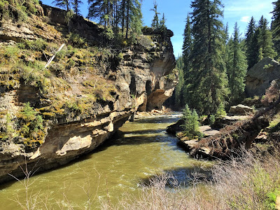
"Two roads diverged in a yellow wood... And sorry I could not travel both. I took the one less traveled by. And that has made all the difference." --Robert Frost

Thursday, May 26, 2016

How do we find our awesome boondocking sites?

Salida, Colorado
Boondocking - BLM

National Forest outside Nathrop/Buena Vista, CO, CR270

People are always asking me, "How do you find those awesome boondocking spots?"  Well, it's a process.  Not usually too hard, but since Steve still works from the road, having a strong cell signal is a must.  Usually we'll be in a boondocking spot 1 or 2 weeks.  More sometimes if allowed.

We prefer to be out in a forest, by a lake or river near hiking/biking trails, not too far from town and lots of privacy.  Easy right?

  
National Forest outside Nathrop/Buena Vista, CO, CR270
 

First I look at the area we'd like to be at.  What I look at is:

1. freecampsites.net - ease of access (we don't want to be more than a few miles off a paved road).  It has info that describes length of RV that will fit, utilities, websites, maps and most importantly, I like the reviews of others who have camped there to see if what is listed is fairly accurate.  Usually they will comment on internet reception.

2. usacampgrounds.info - Now my favorite as it brings up those gems others don't, like county parks, fairgrounds, airports, racetracks, etc,

3. Campendium.com - another favorite as the reviews are simpler and best for cell coverage.

4. coverage? (app) This shows me how many bars of ATT/Verizon are in the area, if any.

5. rvparky.com - Easy format to see all at once, especially price.

6. ultimatecampgrounds.com - Similar to above.

7. casinocamper.com - If it's just an overnighter I will check county parks, casinos, big box stores such as Cabelas, Walmart, Home Depot, Bass Pro Shop etc.  Most will let you stay overnight and some give free goodies like casino money or even utilities if you're lucky.  I don't really count these as boondocking, but sometimes it just works better.

 
National Forest, Leadville, CO, CR 4

Usually the top 2 are all that is necessary for me to find a spot that will work for us.  We always try to have a Plan B and C just in case the spot doesn't work out or the cell just doesn't work.  Some of the best info I get is from other bloggers.  Especially ones who work as they will mention cell conditions and give nice reviews.  When they find a great spot, most will share it.  I file that away for future reference.
BLM - Salida, CO, CR 194

 
There are other sites I have bookmarked for the Forest Service, BLM and several others, but usually the ones listed above are what I mainly use.

So far, in the past 2 years we've been fulltiming, our top spots have been in southwest Colorado.  There is a lot of National Forest and BLM land that borders the main highways with rivers and lakes all around and plenty of small towns for shopping and services.  Many easy access, large spots that are easy to find.  The sites have been in Salida, Nathrop/Buena Vista, Leadville and Cortez/Durango.

National Forest - Cortez, CO, CR316


Wednesday, May 25, 2016
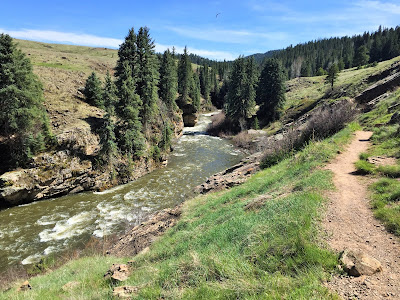
Salida, CO - Awesome Boondocking!

Salida, Colorado
Boondocking, BLM


We were on our way to Salida/Buena Vista area but decided to do a couple days along the way around Del Norte.  The locals pronounce it "Del Nor".  We were hoping to see Summitville Ghost Town.  It's supposed to be one of the most intact old mining towns up in the mountains above 11,000 feet.  Other than that and a brewery, not much more we were going to do but rest up.  The Rio Grande River in town, like all the other so far, is still running too fast and muddy.

What's that up on top of the mountain?

A huge Elk Statue.  Cool.

I had what looked like a great boondocking site.  Had a fellow blogger stay in the area so we didn't bother to check it out first.  The satellite view looked wide open so I didn't think we'd have any problems.  Wrong.  I've been on a bad streak of finding bummer sites.
Looks good enough so far.  Nice, smooth dirt road.  Not the prettiest area.  High desert.  Problem was it was very windy and we were getting sand blasted.  Also, with the raised berm alongside the road, there was hardly anywhere to turn around.  We had to drive much further in than I wanted.  There were a couple spots that were ok, but they had no privacy and were right off the road.  The prime spot I was looking for required us to drive through a wash and some pretty big ruts.  All this to end up with a spot that was very sandy, had huge gopher holes, ant hills and 3 dead animal carcasses.  YUCK!

Plan B.  In town I found a county park you can overnight in for free.  These usually are very nice.  This park turned out to be a gem.  We could park right along the grass next to the river.

Yes, Hoss needs a wash!

What a great front yard for the night.
 
Another bonus was a fundraiser going on in the park to raise money for the local trails.  It was a very small gathering and free to get in.  We were going to ride our bikes down main street to find something to eat and visit Three Barrel Brewery.  As it turned out, the brewery was at the festival and you could sample all the beer for free!  Steve loved the IPAs.  There was a couple food trucks with some great food too.  That's where it ended though.
The band was actually pretty horrible.  I could've sung better.  And those that know me know what I mean!  It was a fun day/evening and we ended it by taking Hurley for a nice walk on the river trail.
 
We drove closer to Salida the next day and since we were going to be boondocking, we decided to stay at a private park and enjoy some FHUs (full hook-ups).  This way we could scout out some spots without taking the trailer.  Best way to do it when possible!  We stayed at Heart of the Rockies RV Park.  It was ok.  For $38 I expect more though.  It was going through new management and getting an upgraded water system.  The flow was very poor so we just used our water pump instead of hooking up.  It was nice to dump the tanks, fill up the fresh and do laundry though.  Very helpful staff.

We drove out to the National Forest Office in town and asked about dispersed camping.  We found out you can dump/fill at their facility for a fee.  Good to know if we need that later.  We got maps and a few spots to check out.  The first was along the Arkansas River which we heard good things about from another RVer.  Didn't care for it. It was very cramped and a lot of homeless stay there.  Not that there's anything wrong with that, just not our favorite type of spot.  Another said you can get 30ish foot rigs up the hill.  NOT!  It was a very narrow, steep, rutted 4x4 dirt/rock road.  Maybe jeeps, small trucks and tents!  Not looking too good so far.
 
We checked out a couple more and fell in love with one about a mile off  Hwy 285 on CR194.  Easy access, flat and the road dead ended in a little box canyon.  Room for about 5 rigs, very private and spaced out.  The ruts weren't bad and the rain hadn't started so we could easily get in.  We went back and got the trailer.
Gorgeous spot on BLM land at the end of the road from the blue dot.
 
When you drive up 194, left takes you back 18 miles to a tiny campground on the river (nothing over 20ft) and to the right takes you right to the box canyon on BLM land.  Free camping for 14 days!  This spot not to be confused with Hecla Junction at the very end of CR194.
 
Steve checking it out to make sure no one was in "our" spot.

The road ends just around that corner.

Looking back towards CR194.

Our spot up against the rock wall.  It was also the only area with a few trees.  We had some nice shade and a great fire ring. 


The outside office.

Looking toward the end of the canyon.
View from the end of the canyon looking towards us.  This spot at the end was really big and had a nice firepit, but was a little too uneven for us.
You can't tell, but it's not as flat as it looks.  Later in the week some kayakers tented out here.  Otherwise, we had the place to ourselves!


This was one of our very favorite boondocking spots so far!  Since I get so many questions on how we find our awesome spots, I'm writing the next post about the process I use.
 
We enjoyed this spot for 14 days.  It was a perfect location to investigate Salida, Nathrop and Buena Vista.  The Arkansas River runs right along all 3 towns. Gold Medal fishing!
 

Saturday, May 21, 2016

Pagosa Springs - Hikes, Waterfalls & Chimney Rock

Pagosa Springs, CO
East Fork NF Campground


We took some great drives and hikes this week.  One of my favorites was north of Pagosa where the Piedra Trail and some others are.  There are also many waterfalls in the area.


The Aspen aren't leafed out here yet, but it was so green and the dandelions were so abundant.  I know most people sure don't want them in their lawn, but here, the yellow was such a happy sight.


Williams Creek Reservoir.  We watched the eagles soar above.  There are some very nice forest service campgrounds around this lake.

 
A nice little hike takes us to Piedra Falls.  You can only get so close without getting soaked by the spray coming off these falls as the water comes down with such force!


Beautiful views everywhere.  You could drive around these dirt roads for days.
 
 I was looking forward to doing the Piedra Trail.  It's an 11 mile, easy trail.  It starts out at 8240' elevation and has about a 1200' gain.  A great way to hike at a higher elevation without a huge gain.

 
Steve and Hurley leading the way.  It's a beautiful trail that starts in an Aspen and Fir groves.  It follows the Piedra River.


It quickly narrows and takes you through an amazing rock box canyon.


Crazy shaped rocks and boulders.


I like the pine tree growing on the pointy edge of the cliff.

 
It then opens up and takes you through meadow after meadow.
 
A snake Hurley found.
 
Beautiful flower covered meadows.

 
We loved this hike!

We were expecting to see Elk, but didn't see much wildlife.  Hurley found something stinky to roll in and he had to get a cold bath in the river afterwards!
 
Steve doing a Yoga pose for our RV friend, Pam!  Not bad, eh?
 
Ghostly Aspen among the pines and firs.

 
This is also a popular place to rock climb.  On our way back we watched these two for a bit.

A great day on the trail.  Time to get back and have some dinner.

These two pooches were enjoying their ride in the truck.

Later in the week we had plans to go the Chimney Rock National Monument.  You can see it rise above the valley while driving through the area.  No dogs allowed but they had a very nice shaded kennel with grass where some nice ladies visited with Hurley while we were hiking.


You start at the Visitor Cabin at 6,600 feet elevation. Walking tours begin in the upper lot at 7,400 feet elevation. Guided walking tours end at the Great House Pueblo at 7,600 feet elevation.  We did both.  So much information on how these structures came to be, what they were used for, who used them and what happened to them.
See that flat spot at the very top.  That's where we're headed.

This is what it looks like as you get closer.  Nice hike.

Great 360 degree views from up here.


An 80 million year old worm fossil.
 
A wealthy ranch owner owns much of this property you see.

Nice, huh?
 
 
The way they layer the rock and how precise they are is amazing.  On the left is the more modern way compared to the haphazard way on the right.

Quite impressive!


The pit house at the very top sits with an amazing view.  They are still not sure if it was for security or they used it for special ceremonies. Or both.  It is said that they can light a fire here and it can be seen for hundreds of miles away.  Sort of like an invitation.  Other tribes do the same and it becomes quite the party.


Just beyond are the chimney spires.  You are not allowed any further.  They have nesting Golden Eagles and don't want them disturbed.


Found a heart in the bark of a tree.  Sometimes I find them in rock shapes or cactus.
 
A drive to the pass and another hike to a waterfall.
 
Treasure Falls is right along Hwy 160.  A short but steep hike takes you to some nice viewing platforms.


Wolf Creek Pass at 10,857' elevation, has some fantastic views from a short hike off the observation area.  The entire valley opens up.


At the top of the pass you come upon the Continental Divide once again.  There is still plenty of snow and some lakes are still iced over.  We keep making plans to do some higher elevation hikes to get us accustomed to the thinner are to build ourselves up for summiting a 14er later.  Problem is, once you get up that high the roads are impassable and the trails heavy with snow.  Duh. 

Avalanches are such a problem here, they have barriers for special sections of the road.  Look how thick they are!  That a serious barrier.
 
Now this was very interesting.  On the way back down the Pass we were curious about these vehicles that were backed right up to the edge of a cliff.  This was a huge pull out and no one else was there.  So why are they parked like that?
 
Notice the rope tied on the bumper going over the edge?

Straight down!

We talked to the crazy guys at the bottom once they came back up.  They actually take those kayaks down on their backs, all wetsuited up, down over the edge!

Apparently there is a tiny stretch of river after it comes down a fall that they all look forward to riding when the water level is just right.  It is a crazy amount of work to get down there.  Then it took them quite a while to get into the kayak as the water is raging.  It was a very short ride then out they came and hiked back up a little bit further down.  CRAZY!  I don't think I could hike up that steep section let alone carrying a kayak and gear all while wearing a wetsuit!
And back up they came.
 
Our time in Pagosa Springs is over and we're headed to Salida with a quick stop over.