Brookings, Oregon
Harris Beach State Park
What does a WWII submarine have to do with Oregon?
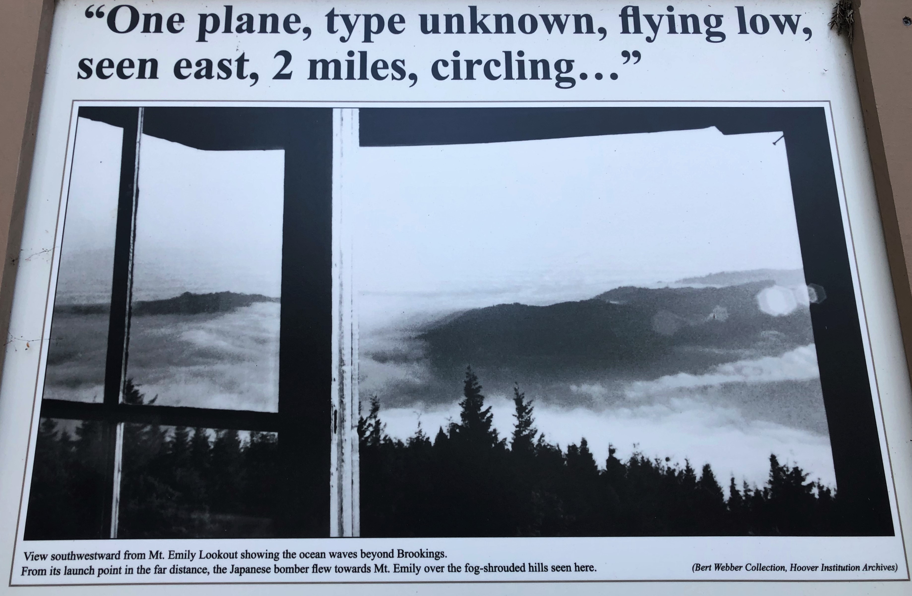
I didn't know there were any WWII bombings that took place on the US Mainland. There were actually two. In June of 1942 there was a bombing at Ft. Stevens Army Base. This
site we visited a few years ago. Then recently we learned there was another in Brookings which happened in September of 1942. If you are adventurous enough, you can hike to it. We decided to try it after we kayaked. First though, we would stop back in to
Superfly Distillery for breakfast to charge our batteries.
Steve had Chicken Fried Steak in Gravy(top) and I had the delicious Egg, Potato, Bacon Tacos.
Of course we had to start with a Bloody Mary made with their own vodka.
Our intention was to drive up to Loeb State Park and put-in at the Chetco River from there. We decided we'd paddle up river against the current and float back down. Problem was, the current and tide were against us, up river and it was cold and windy. I was still recovering from my sinus infection and Bronchitis so we bowed out and decided to search for the Bomb Site instead.
 |
| We are at the orange dot. The bombsite is #16. The town, and our starting spot, is to the left, just outside the picture. So going clockwise, it was a big, long loop. |
This large loop would leave us heading to the bomb site in reverse of what I had originally planned. I had it carefully mapped out the other direction as it is not really a marked or known about place. I had a combo of directions from Geocaching, my trail apps and a couple other sources and felt comfortable that we could navigate the national forest dirt roads. Even if we did not find it, it would be a great drive through the forest.
It didn't take long driving up the road parallel to the Chetco to find it didn't go much further before turning into a small creek. So we wouldn't have been able to paddle very far at all. Good choice then.
After crossing the bridge, the pavement turned to dirt/gravel. The road was a good width, in good condition with brush and trees cleared back. The Dogwoods were still blooming.
We drove through many parts of the forest that had burned in previous years.
See how nice the road is? We calculated it would be about an hour drive at most.
After a few other turnoffs down more forest service roads, they got narrower and less cleared. We had to get out several times to move downed trees, branches, logs, rocks etc. Still, not too bad.
The Trillium was blooming also.
We had only passed one truck cutting wood until we came upon this surprisingly new looking sign. Then a couple on a Razor stopped and we chatted with them for a bit. They told us what a neat spot the bombsite trail was but warned us that we should retrace our way back instead of continuing on after the hike to get back to Brookings. As you can see in the above picture, the downed trees were huge and more numerous and they didn't think our dually could fit through. We'd think about that after the hike. To get back retracing our drive would be closer to 1 1/2 hours compared to maybe 1/2 hour if we continued our loop drive.
Right off the bat the downed trees covered the trail and we had to climb over, under and around them.
It wasn't far at all and up the first hill you came to these new looking informational signs.
(Here is a
LINK to info on other US WWII Attacks as well as this one)
On my Geocaching App the trail is marked as well as a cache. From the other info I had the bombsite was listed as about a mile hike in. Unfortunately, the area is rather remote and Mother Nature has regrown some vegetation. That combined with all the fallen trees made the area hard to read. Surprisingly, the trail was in pretty good condition for the most part.
Off we go, following Hurley hoping to find the actual crater from the bombing as well as the geocache. Our info read that it was not too far from the second bench.
There are so many blackened Redwood trees along the way. It was strange that the trunks were totally black, with not many branches left.
However, new growth grew out of the trees completing covering the trunks giving them a strange pillar look.
Up and down the trail went.
We came up to what we figured was the first bench. It wasn't hard to spot but there were downed trees and brush all around it and the trail. We figured this was a short out and back trail. It felt like we had already gone a mile and were surprised that this was the first bench we saw. While the bench looked like it had been here for some time, the plaque looked fairly new.


We walked for another 1/2 mile then began to question the location. For one, we could see the trail kept going for quite a bit so it must not be an out and back. We never did see another bench. We did come to an area where the trees were burned in a circular pattern from the inside of what we guessed may be the bombsite, which made sense. We were expecting to see a crater but it looked more like a draw to me. Since it was getting late and we weren't sure which way we would be driving, we headed back happy enough that we actually found the roads, the trailhead, the info signs as well as enjoyed a nice hike. Never did find the cache either. It kept pointing way down an overgrown hillside.
Once back down, I walked ahead past those huge cut trees to check out the road. It didn't look too bad to me and we didn't want to get caught in the dark trying to find our way back out on the forest roads. So we drove ahead while Steve managed to skillfully weave in and out of the cut trees.
We had to constantly get out and move more debris. Some we drove around, some over and some under. Yes, we did add a few pinstripes to the truck a time or two. Or three. Ouch.
After a couple of miles it seemed smooth sailing and less trees in the road. Until we hit a narrow section that was washed out on one side. To get by, you just had to run the bank up the hillside a bit. Easy if you're on an ATV. Not so much in a dually. Steve got out to give it a good look.
Or two. Or three.
The road was dry, fairly hard packed with hard rock. The underside of the slide looked dry and pretty stable. I told Steve I'd guide him as close to the hill as I could. There was a boulder sticking out right on the banked section so he had to be careful not to get too close and rub the caps on the rims. He was very nervous about the hillside but gave it a try. He changed his mind and backed back up. I told him he should guide me and I would drive. (I'm a bit more... brave... daring. He did a great job guiding me as I zoomed up the bank and to the other side of the slide. We had a good, nervous laugh and continued on. Too bad we didn't video it. A few flooded water crossings later and we made it back safe and sound. Just before it got dark. What a fun day it turned out to be!

Once back we took out the fresh Ling Cod we bought off the dock and sauteed that in some lemon and garlic. Combined with some fingerling potatoes and a big fresh salad from the farmers market and a Pinot Grigio, it was the delicious end to another great day on the Oregon Coast.