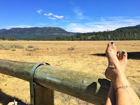
Scott's Lake NF
During our second week boondocking up here in the Sierra Nevada, just south of Lake Tahoe, we did some geocaching, relaxing and more hiking.
Near the Carson River, over a hill was this huge juniper tree. The tree wasn't all that tall compared to how thick the trunk was.
There was a guardian under the cache. A big frog.
One cache you had to find a bearing in a different direction after we found a large boulder with a small plaque on it. It was a sweet Memorial Plaque far out in a meadow. From there you had to follow the bearing direction and a hint to get to the cache. We aren't too good at these, but getting better.
And we found it! Under a pine tree across the river.
Some days we just relaxed all day, worked on the blog and played fetch in the meadow.
Hurley enjoyed chasing the sticks I threw for him.
Playing fetch is pretty exhausting, but someone has to do it.
This was a great place to spend Labor Day weekend. While we had a few more people join us, like these horses, it was very quiet overall.
Steve's drivers license will expire in October and he had nothing but problems trying to renew it online. We decided to take a drive to South Lake Tahoe and see what the lines were like at the DMV. It turned out, not bad. So he turned in his info and paid. All that was left was to print out his temporary license. That's when the printer died. Sheesh. We'll just come back in a few days. Since we had some time we decided to find a few caches and see a movie.
Here was a cache hidden right on the border of California and Nevada. Pretty fun.
After the movie we went to Applebee's for some cheap eats and drinks.
Over the weekend we did a couple of hikes. The first one was easy and took us to a cave where Snowshoe Thompson would hold up when the snow was particularly bad while delivering mail during the winter when the Pony Express could not ride.
You had to cross over a log-type bridge to get through the muddy creek.
Above is the cave in summer, below, with some snow around it.
We loved this spot so much we hid an Earthcache (a type of geocache) here. Look it up if you're in the area.
The California Trail is an emigrant trail of about 3,000 miles across the western half of the continent from Missouri to California. The cave is along this route.
We also hiked Horsethief Canyon. It is 3 miles round trip and begins at 6,658 feet altitude. There is a total elevation gain of around 1,300 feet. The first half of the trail is steep and mostly in the sun. Eventually it follows a tributary of the West Fork of the Carson River so there is water year round. This was the only way we could bring Hurley up something this steep and hot. He just can't do these types of hikes anymore without water along the way.
The smallest trickles he would lay down in to cool off and get a nice drink of water.
Once the creek was accessible, he jump in and lay down and play. We made sure he got plenty of time to rest too.
These bluffs looked so far from the bottom, but now they are getting closer!
"Are we there yet?!!"
Almost there!


I loved the colors of the lichen on the rocks. So bright!
I liked the almost perfect square shape of this boulder.
The final steep climb meant hiking in finely ground granite. Just like sand. One step up, you'd slide two steps back.
At the top! There were a few geocaches along the trail and one at the top that Steve found. It was amazing that he found it as it was the remnants of a gunshell in a rotten tree about 100 feet long and 3 feet tall with SO many places it could be hidden.
A little tunnel of Aspens.

We hiked down pretty quickly compared to climbing up.

It was another great week. We've had so much fun that we decided to stay another week.
I connect with this so deeply.


As always great pictures, especially of Hurley. How many geocaches have you found so far?
ReplyDeleteWe are almost at 5000 geocache finds!
DeleteLove all the Hurley pics!! Such a handsome boy. That was quite the trek, but those double falls are beautiful.
ReplyDeleteHurley does love his hiking.
DeleteInteresting geocaches in that area. We have not done many that require you to go to one spot and then carry on to another. Sounds like those would be a little more challenging.
ReplyDeleteThey are Multi's. Yes, more challenging. Such a pretty area.
DeleteGreat post, Debbie! Those are some awesome trails!
ReplyDeleteIt's a great area for hiking, fishing and kayaking.
DeleteGreat hikes! Hurley is such a good boy. The cooling vest I mentioned on FB is sold at Ruffwear. Hopefully this link shows up: https://ruffwear.com/products/swamp-cooler I had to renew my driver's license last month. I went in the afternoon. In and out in about two hours total time. I got the new federal compliant one.
ReplyDeleteI'll check it out. Thanks for the link Rene.
DeleteGlad Hurley was able to enjoy the hike too. Looks like some great trails.
ReplyDeleteSo much wonderful hiking out here.
Delete